|
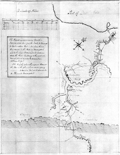
George Washington’s map of the
Pittsburgh area drawn for the
Ohio Company, which was chart-ered by
Virginia at the same time as the Loyal Company.
The French and Indian War
Geography was everything.
The prize was the Ohio and Mississippi River Valleys.
Both the French and English wanted and claimed it.
The English had possession of the Atlantic Coast, and a
massive over population of their own and of German people who
were being driven out of Europe by the French.
The French had a tortuously long canoe route into the
interior of the continent over which they had to move people and
armies. The English had
the world’s largest navy with which to pour people and material
onto the continent.
However there was a chain of nearly impenetrable mountains
separating the two aspiring combatants.
There were two routes through the mountains connecting
the two empires, and both lay through Virginia.
One route was down the Ohio River, which has two heads,
one (the Alleghany) on the Great Lakes, and the other in
Virginia (the Monongahela).
These two heads of the Ohio come together at present
Pittsburgh. The second
route into the Ohio Country is down the Great Valley of Virginia
and on through Cumberland Gap into Kentucky.
It was inevitable that the conflict occur, and that it
involve ...
Continue to Page 12
11

Return to Big Stone Gap Publishing.com
Copyright © 2014 Lawrence J. Fleenor, Jr.
All Rights Reserved
|